
Live Oceanographic Data Analysis, Dynamic Source Discovery, and Regional Sea Water Temperature Guide from Coasts to Oceans: The Google Drive Folder Information Containing the SKILL.md File That Anyone Can Directly Download and Use on Their Own System Is Provided at the End of the Article
Aydın Tiryaki
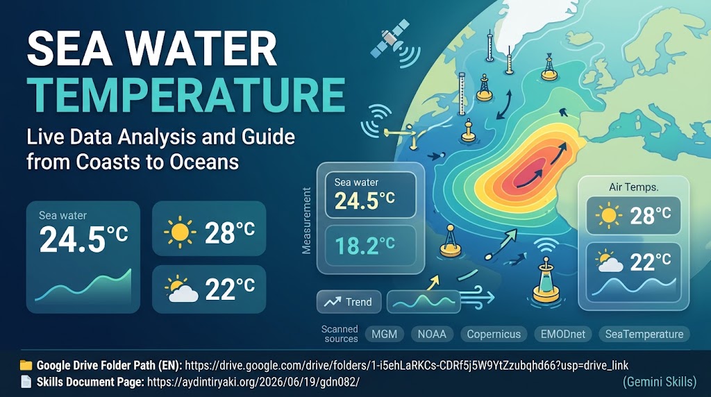
For coastal residents, travelers, water sports enthusiasts, mariners, and climate researchers, obtaining accurate and up-to-date sea water temperature data for a specific beach, bay, or coast is often much more challenging than it appears. Standard weather applications typically focus almost exclusively on atmospheric temperatures, either omitting sea surface temperatures altogether or providing a single generalized estimate for an entire province. However, due to local currents, bathymetry, upwelling, and wind patterns, significant temperature variations of several degrees can occur even between neighboring bays or across a strait within the same city. Sea Water Temperature (Skills Edition) is a specialized artificial intelligence skill engineered to bridge this gap by analyzing and presenting current sea water temperatures alongside regional weather conditions through geographical distribution and representative sampling.
Throughout the operational architecture of the system, sea water temperature remains the primary focus at all times. When a user queries a specific beach, coastal city, or maritime region, the assistant scans all active measurement stations at that location and in its immediate vicinity. Sea water temperature values are consistently highlighted in bold font accompanied by contextual marine and climate emojis for immediate visual recognition, while daytime high and nighttime low air temperatures are presented right beside them as secondary contextual data.
One of the defining capabilities of Sea Water Temperature (Skills Edition) is its scale-aware geographical grouping and sampling methodology. When a user requests data for a wide metropolitan coast, the system lists all measurement stations within that zone grouped by geographical direction (such as North, South, West, or in a structured text-based map layout). When the query spans a massive geographical scale—such as an entire country or a continental coastline—instead of overwhelming the output with hundreds of raw station points, the system constructs a meaningful and representative sampling across distinct coastal zones to deliver an inclusive overview. Across all lists and interactive menus, standard numerals are replaced with emoji numbers (1️⃣, 2️⃣, etc.), while keeping main section headers clean and strictly free of emoji leakage.
To ensure scientific rigor and comprehensive coverage, the skill operates on a multi-tiered oceanographic scanning architecture (“Sources and Dynamic Data Discovery Protocol”): 1️⃣ Official National Meteorological and Oceanographic Networks: For regional and coastal queries worldwide, priority is given to official national meteorological and hydrographic institutions, including NOAA/NWS (USA), UK Met Office, DWD and BSH (Germany), Météo-France, AEMET and Puertos del Estado (Spain), JMA (Japan), BOM (Australia), and MGM Piri Reis Marine Pages alongside ONHO/SHOD (Türkiye), as well as university marine science institutes and live municipal or marina coastal sensor networks. 2️⃣ Global Scientific and Satellite Oceanography Sources: For global and offshore analyses, primary scientific references include NOAA (NDBC National Data Buoy Center, Coral Reef Watch, and OSPO satellite SST analyses), Copernicus Marine Service (CMEMS), EMODnet (European Marine Observation and Data Network), NASA Earthdata (MODIS and VIIRS satellite sensors), EUMETSAT OSI SAF, Met Office (OSTIA), and the Argo Global Oceanographic Float Network. 3️⃣ Global Coastal, Beach, and Water Sports Data Platforms: For localized beach, bay, and surf-zone precision, the system actively queries SeaTemperature.org, Seatemperature.info, Seatemperature.net, Surfline, Surf-Forecast, Windguru, Windy.com (SST layer), Tideschart, and Meteoblue databases. 4️⃣ Dynamic Source Discovery and Continuous Expansion Requirement: Recognizing that new oceanographic satellites, smart buoy arrays, academic monitoring networks, municipal coastal sensors, and web platforms are continuously launched over time, data scanning is never restricted solely to the fixed sources listed in the instructions. During every single query, the system actively performs live web searches to discover, verify, and integrate newly established sea water temperature sources beyond its predefined list.
Whenever different sources report varying sea water temperatures for the exact same location—for instance, due to methodological differences between in-situ coastal buoy sensors and satellite skin temperature readings—the system lists each measurement separately without rounding or averaging, clearly attributing each figure to its respective source. Furthermore, to enrich the geographical, climatic, and oceanographic context of the queried region, the assistant scans Wikipedia, authoritative knowledge portals, and YouTube videos or playlists, providing them as directly clickable open URLs rather than generic search result links.
At the conclusion of every response, users are presented with a standardized 9-option Visual and Video Production Menu. Depending on user selection, the system generates either “With Text” infographics (.jpg or .png) featuring structured data panels in clear typography supporting local characters, or strictly “Textless” scenic visuals and “Video” (.mp4) outputs rendered with complete geographical and architectural fidelity to the queried coast. Additionally, an interactive Living Assistant can be triggered at any stage via “Guide”, “Handbook”, or “Help” commands to provide Summary, Detailed, or full Index documentation, while a dual-layer Universal Data Verification protocol cross-checks anomalies and issues a transparent Hesitation Notification if discrepancies persist.
Developed with ATG Gem Factory (Skills Edition) v14.10, version v01.08 (GemStat:1 – In Development) of Sea Water Temperature is cataloged under repository number gdn082. Comprising a total of 6706 characters (Title: 21, Description: 975, Instructions: 5710 characters), its dedicated Skills Document Page is directly accessible at https://aydintiryaki.org/2026/06/19/gdn082/ .
Google Drive Folder Link and SKILL.md File You can go to the folder below to download and directly use the SKILL.md file from this folder. 📁 Google Drive Folder Path (EN): https://drive.google.com/drive/folders/1-i5ehLaRKCs-CDRf5j5W9YtZzubqhd66?usp=drive_link Note: You can make your own developments and edits on the SKILL.md file you obtain from here. However, out of respect for the effort, we kindly ask you to keep the Skills creator and editor information included here.
The Sea Water Temperature (Skills Edition) design introduced in this article was designed and developed by Aydın Tiryaki, and all content, architectural approaches, and views in the article belong to the author; the editorial and writing assistance for the article was performed by Gemini 2.5 Pro (Operating Mode: Pro, Thinking Level: Standard) (28.10.2026 14:47).
| aydintiryaki.org | YouTube | Aydın Tiryaki’nin Yazıları ve Videoları │Articles and Videos by Aydın Tiryaki | Bilgi Merkezi│Knowledge Hub | ░ Virgülüne Dokunmadan │ Verbatim ░ | ░ Deniz Suyu Sıcaklığı │Sea Water Temperature (Gemini Skills) ░ 28.10.2026

